 Fagradalsfjall Volcano Trips
The Best Photo Spots at Fagradalsfjall
The best photo spots at Fagradalsfjall are fixed viewpoints above cooled lava, not windows onto an eruption. The 2021, 2022 and 2023 eruptions built three separate photo destinations on one hillside: the Geldingadalir crater, the Meradalir valley and the Litli-Hrútur cone. This page walks through each spot, the trail that reaches it, the light you can expect by month and time of day, and the aerial option from a helicopter. For the walking itself, turn to the full guide on visiting Fagradalsfjall without a tour, and for costs see the Fagradalsfjall tour list.
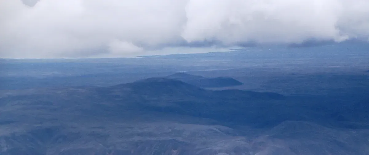
Langihryggur is the long ridge that separates the coastal road from the Fagradalsfjall highlands. Photo: Bjoertvedt, CC BY-SA 3.0, via Wikimedia Commons
Quick answer Photo spots at a glance
The best photo spots at Fagradalsfjall are the Langihryggur ridge, about 4 km one way along Path C, the rim above the Geldingadalir crater from the 2021 eruption, the Meradalir valley from the 2022 eruption, and the Litli-Hrútur cone from 2023. Nothing is erupting now, so you are photographing black lava fields, cones and craters, not flowing lava.
Key takeaways
- The shortest walk to a good frame is the yellow Nátthagi path, about 2 km one way.
- Want the crater and the valley from above without the hike? The Fagradalsfjall helicopter flight passes over Litli-Hrútur, Geldingadalir and Fagradalsfjall in a 40-minute flight.
- A guided hike such as the small-group Fagradalsfjall volcano hike builds photo stops into about 3.5 hours at the volcano.
- Going under your own steam? Start with the guide to visiting Fagradalsfjall without a tour for trails and parking.
What You Will Actually Be Photographing
Set expectations before you pack the camera.
No flowing lava, at any of these spots
The Icelandic Met Office reported no active eruption in its latest update. The most recent eruption in the area, the ninth of the Sundhnúkur series, ended in early August 2025. Every photo spot on this page looks at cooled lava from the three Fagradalsfjall eruptions: 2021, which ran 19 March to 18 September 2021 and produced 151 million cubic metres of lava, 2022 at Meradalir, and 2023 at Litli-Hrútur.
Since late 2023 the eruptions have moved to the Sundhnúkur crater row near Grindavík, a few kilometres northeast. You can see that newer lava field from some Fagradalsfjall viewpoints, but the Sundhnúksgígar site itself is closed, with no hiking trails or parking areas defined there. Any tour photo promising orange rivers at Litli-Hrútur is older than the current situation, and some operator listings have carried that stale language for years.
The upside for photographers is real: black fields, cracked crust and a raw landscape with almost nothing built on it.
The subject can change without warning
The ground under nearby Svartsengi keeps rising. The Met Office measured roughly five centimetres of uplift over the past three months, with about 29.1 million cubic metres of magma accumulated since the most recent eruption. Its own wording is that a magma intrusion propagating into the Sundhnúkur crater row remains the most likely scenario, and that a short lead time must be expected before any new event.
In practice that means a new eruption can close trails, roads and viewpoints at short notice rather than open them. Check safety at Fagradalsfjall before you plan a shoot, and treat any frame you get as luck of the calendar, not a right.
The Photo Spots, One by One
Each spot below pairs a viewpoint with the trail that reaches it, using the official path distances.
Langihryggur Ridge, the panorama spot
Path C, the green route up Mount Langihryggur, is about 4 km one way and looks out over all three Fagradalsfjall eruption sites from 2021, 2022 and 2023 at once. That makes it the single most efficient photo position on the mountain if you want variety from one stand. The trade-off is in the official trail note: from the ridge you cannot see the crater itself. You are shooting the valleys and flows, not a cone.
The ridge also works as a foreground in its own right, a long spine of older rock with fresh black lava on either side. An official elevation figure for the ridge is not stated by any government or geopark source, so plan for wind rather than for a specific height. Fagradalsfjall itself, which anchors the wide frames, stands 385 m (1,263 ft).
The Rim Above Meradalir
Meradalir hosted the 2022 eruption, which ran 3 to 21 August 2022 and added about 12 million cubic metres of lava on top of the 2021 flows. Reaching it properly is the biggest commitment in the trail network: Path E runs about 18-20 km both ways and takes 5-6 hours of hiking before you count any time standing still with a camera. The terrain is rated challenging and crevasses can be expected, so stay on the marked path.
The reward is space, and you can shoot the 2022 crater from above the flows. If the full route is too much, the rim views from Path A over the same valley come at a fraction of the distance.
The Geldingadalir Crater and the 2021 Flows
Geldingadalir is where the whole story started, on 19 March 2021, and by mid-September 2021 its lava covered 4.8 square kilometres. Path A to Mount Fagradalsfjall runs about 6-8 km one way and takes 2-2.5 hours, passing all three eruption sites. The classic composition is the small cone against the dark field, with hikers on the trail giving scale.
Remember the one hard rule that applies to your feet, not your lens: walking on the lava is strictly forbidden even now, because the crust can still be thin over hot rock. Set up your tripod on the marked paths and let the lava stay in the frame only.
Litli-Hrútur, the 2023 Cone
Litli-Hrútur erupted from 10 July to 5 August 2023, produced roughly 15.9 million cubic metres of lava and covered about 1.5 square kilometres. It began significantly stronger than the previous two eruptions, and the cone reflects that: a compact, photogenic heap sitting in its own field. Path A passes the 2021, 2022 and 2023 sites, so it combines naturally with the crater shots in one hike.
This is also the spot most often misrepresented online. At least one tour listing was still advertising erupting lava at Litli-Hrútur long after the flow stopped in August 2023, and a BusTravel listing carried an old note about the area still smoldering. The cone today is dark, quiet and very photogenic in low light.
The View Toward Sundhnúkur
From high points on the Fagradalsfjall trail network you can look northeast toward the Sundhnúkur crater row, the line of vents that produced nine eruptions between December 2023 and August 2025. The biggest of those, in August and September 2024, put out about 61 million cubic metres of lava. Long-lens shots of that newer black field are the most current image you can take on this peninsula.
Path B, the dark blue route from P1, runs 4.7 km one way to the first viewing site and 6.1 km to the second, aimed at the Sundhnúksgígar direction over challenging terrain. You cannot hike into the Sundhnúksgígar site itself, which is closed with no defined trails or parking, so the viewpoint is the only honest way to shoot it from the ground.
Nátthagi, the Short Walk to a Good Frame
The yellow Nátthagi paths are about 2 km one way, much shorter and easier than everything else here. If you have one hour and a car, this is the highest return per minute of walking on the whole mountain.
It is also the spot several tours use. The cheapest listing on the site, a 6-hour minibus circuit of the volcanoes and Grindavík, includes a short Nátthagi viewpoint hike of about 1 hour, and the Click Tours Grindavík and Krýsuvík tour uses the same viewpoint on a nearly identical route. For families and anyone limiting walking, that is the practical photo stop.
Best Photo Spots At Fagradalsfjall on Video
The Langihryggur route and its view over all three eruption sites. Third-party video by Travel with Tiffa. We did not shoot it and have no relationship with the creator.
Which Trail Reaches Which Photo
The table below lines up every marked route against the photo subject it delivers, using distances and times published by Visit Reykjanes. Use it to match your legs and your memory card to a route before you drive out.
Trails and the photos they give you
All figures come from the Visit Reykjanes hiking and parking page. Parking at either car park costs 1,000 ISK (about $8) per 24 hours, paid through the Parka app.
| Trail | Distance one way | Hiking time | Best photo subject |
|---|---|---|---|
| Path A to Mt. Fagradalsfjall (pink) | About 6-8 km | 2-2.5 hours | Crater views across all three eruption sites |
| Path B (dark blue) | 4.7 km to B1, 6.1 km to B2 | Not stated | The view toward Sundhnúksgígar |
| Path C up Langihryggur (green) | About 4 km | Not stated | All three eruption sites, but not the crater itself |
| Path E to Meradalir | About 18-20 km both ways | 5-6 hours total | The 2022 Meradalir crater and valley |
| Nátthagi paths (yellow) | About 2 km | Much shorter than other routes | A short walk to a viewpoint |
Driving and parking basics for a photo trip
Fagradalsfjall sits about 40 km (25 mi) from Reykjavík. Travel-guide reporting puts the drive from Keflavík International Airport at roughly 20-30 km, about 20-30 minutes, with no single official figure published. The two car parks are P1 at Geldingadalir and P2 at Stóri-Leirdalur, and the 1,000 ISK (about $8) ticket is valid for 24 hours.
Portable toilets are sometimes set up at the main lots, though no official page confirms them, and there are no cafés or shops at the trailheads, so carry your own water and snacks.
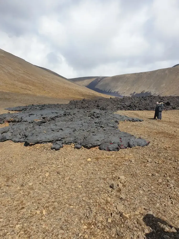
Lava spilled over the low pass into Nátthagi in May 2021, burying part of the valley floor that hikers cross today. Photo: Berserkur, CC BY-SA 4.0, via Wikimedia Commons
Light by Month and Time of Day
The lava does not care about golden hour, but the light still decides the image.
What the climate numbers mean for your photos
The 10-year average daily temperature at Fagradalsfjall peaks at 11.1C in July and sits at 8.4C in September, dropping to 0.6C in January. Official Keflavík Airport normals put average daily highs at 14.2C in July and 3.4C in January. Cold does not hurt the photography, but it drains batteries and fingers, so pack for it.
Daylight is the real constraint. In September, Reykjavík sunrise moves from 06:10 to 07:34 across the month and sunset from 20:47 to 19:03, averaging about 13 hours 3 minutes of light a day. Plan the hike around those hours, because hiking out in the dark over lava fields is a safety problem first and a photography problem second. From late August through mid-April, general travel-guide consensus puts the northern lights season over the peninsula, and one volcano hike and northern lights night tour pairs a Meradalir hike with an evening aurora run, though aurora conditions are never guaranteed.
| Month | Area daily mean | Keflavík avg daily high | Photo character |
|---|---|---|---|
| January | 0.6C | 3.4C | Short dark days, snow accents |
| April | 4.4C | 6.7C | Lengthening days |
| July | 11.1C | 14.2C | Warmest month, long days |
| September | 8.4C | 11.1C | About 13 hours of daylight, aurora season begins |
| December | 1.2C | 3.7C | Shortest days, blue tones |
Time of day on the mountain
No site-specific golden-hour data is published, so treat this as planning logic rather than measurement. Low sun rakes across the flow textures and lifts the crust detail that flat midday light flattens. Overcast is common here and suits the wide black landscapes, while direct hard sun suits the crater cones.
If you can, be on the ridge near sunset within the daylight hours above, and have a headlamp in your pack for the walk back outside summer.
Sources: Icelandic Met Office, Visit Reykjanes hiking and parking, timeanddate.com
The Aerial Option
One tour on the site photographs these spots from the air.
What the helicopter gives a camera
The new volcanic area helicopter flight with GlacierHeli costs $514 and lasts about 40 minutes, flying over Litli-Hrútur, Geldingadalir and Fagradalsfjall, with roughly 20 minutes of that over the eruption sites. It flies a 5 or 6-seater machine limited to 5 participants, and needs a minimum of 4 passengers to operate, with a full refund if the minimum is not met. Multiple travelers report an unadvertised landing on the lava field, though the listing does not promise one.
This is the only way on this site to get the eruption sites in a single frame with real altitude, and at $514 it runs roughly 3 to 4 times the price of the ground hikes, the next dearest being the volcano and Blue Lagoon day trip at $272. The listing is honest that visible lava cannot be guaranteed, which matters, since there is no lava to photograph from any altitude today. If your budget is ground level instead, the Fagradalsfjall volcano tours price comparison lines up every hike by price and time at the volcano.
Tours That Build In Photo Time
Time standing still with the camera varies a lot between listings.
Comparing time at the volcano and what it costs
The figures below come straight from each tour listing. The key column for photographers is time at the volcano, because that is the window in which every frame on this page gets taken. Free cancellation is 24 hours on every listing shown.
| Tour | Price | Time at the volcano | Group size |
|---|---|---|---|
| Small-group hike with 2Go Iceland | $157 | About 3.5 hours of hiking and photo time | Up to 8, up to 13 at the volcano |
| Hike with a geologist | $159 | 1-1.5 hours each way over rough terrain | Limited to 6 |
| Icelandia volcano and geopark tour | $133 | About 2 hours, 5.5 km round trip | Not stated |
| Minibus circuit with Nátthagi stop | $113 | About 1 hour viewpoint hike | Not stated |
| Helicopter flight | $514 | About 20 minutes over the sites | Limited to 5 |
Photo Trip Dos and Don'ts
The rules that protect both your pictures and you.
Do
- Do check the gas forecast at loftgaedi.is before and during the shoot, because volcanic gas is odourless, invisible and can collect quickly at the site.
- Do carry water and snacks, because there are no shops or staffed kiosks at the trailheads.
- Do use a guide such as the geologist-led hike if you want the geology in your captions explained while you shoot.
- Do save the emergency number 112 in your phone, with 599-0112 as the backup for poor connections, and consider the free 112 Iceland app.
Don't
- Don't walk onto the lava for an angle, because the crust can still be thin over hot rock and it is strictly forbidden even now.
- Don't fly a drone without checking the current rules with the Icelandic authorities yourself, because this page does not state them.
- Don't trust tour photos of flowing lava, because nothing has erupted since 2025 and some listings still show 2023 material.
- Don't start the Meradalir route late, because Path E is 18-20 km both ways and 5-6 hours before any photo stops.
Photo Spot Questions
What is the best place to photograph Fagradalsfjall?
For one position with the most subjects, Langihryggur along Path C is the pick, about 4 km one way, because it sees all three eruption sites at once, though not the crater itself. For the shortest good walk, Nátthagi is about 2 km one way. The full trail options are laid out in the guide to visiting Fagradalsfjall without a tour.
Can I get photos without a tour?
Yes. There is no entrance fee, parking at P1 or P2 costs 1,000 ISK (about $8) for 24 hours paid through the Parka app, and you choose your own viewpoints. The practical details are in the without-a-tour guide.
What is the best time of day for photos at Fagradalsfjall?
Low sun shows the lava texture best, so early morning or late evening within daylight hours is the sensible target. In September, daylight runs about 13 hours 3 minutes a day on average, with sunset moving from 20:47 to 19:03 across the month. Month-by-month conditions are in the guide on the best time to visit Fagradalsfjall.
Can I photograph these spots from a helicopter?
Yes. The 40-minute GlacierHeli flight costs $514 and passes over Litli-Hrútur, Geldingadalir and Fagradalsfjall, with about 20 minutes over the sites, for a maximum of 5 passengers. The details are on the helicopter tour page.
Are drones allowed at Fagradalsfjall?
The sources behind this page do not state drone rules for the site, so no permitted status can be given here. Before flying, check current guidance from Safetravel and the Icelandic authorities, and note that the gas plume, when present, is invisible and odourless. General safety rules are covered in the Fagradalsfjall safety guide.
Will any tour include photos of flowing lava?
No, and be suspicious of any listing that implies it. The Icelandic Met Office reported no active eruption in its latest update, and the most recent eruption ended in August 2025. Several listings still carry years-old eruption text, which the guide to common Fagradalsfjall mistakes explains how to spot.
Is a phone camera enough for the Fagradalsfjall viewpoints?
For the wide landscapes from Langihryggur or Nátthagi, modern phones do well, especially in the soft light common here. For the long-lens view toward Sundhnúkur, several kilometres northeast, a proper telephoto earns its weight. If you would rather have the geology explained while you shoot, the hike with a geologist caps groups at 6.